DATA PLATFORM
Structured location data
for every place in Europe
A transparent data foundation connecting millions of locations with geographic areas and analytical context across Europe.
01 — DATA FOUNDATION
One Platform. Multiple Geographic Layers.
GeoPulz combines millions of locations with geographic boundaries and spatial indexes in one structured data model. This creates a consistent foundation for analysing places at different geographic scales.
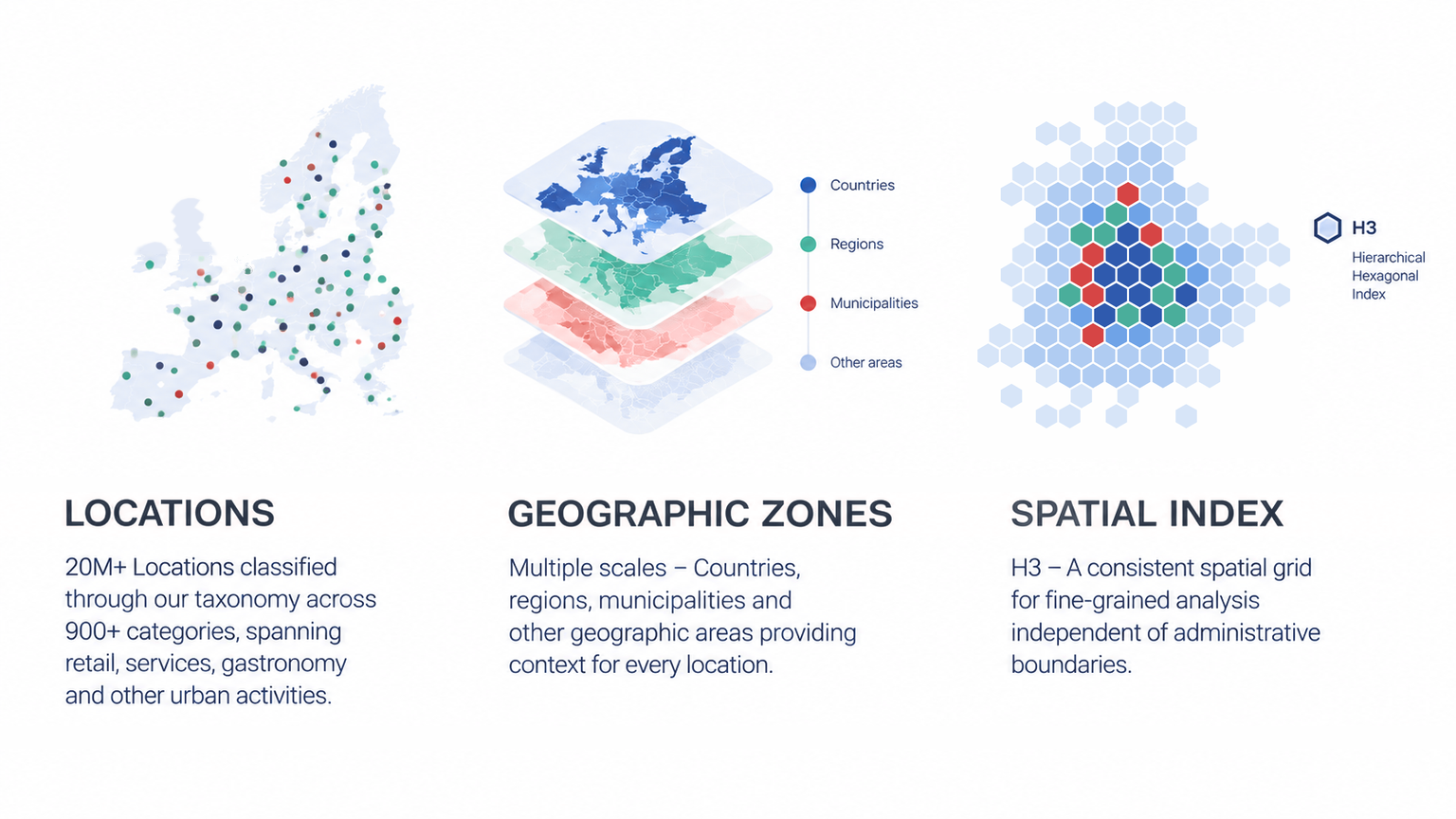
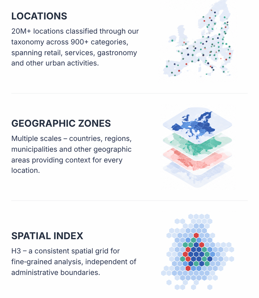
LOCATIONS
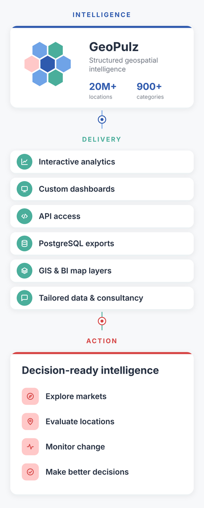
20M+ Locations classified through our taxonomy across 900+ categories, spanning retail, services, gastronomy and other urban activities.
GEOGRAPHIC ZONES
Multiple scales – Countries, regions, municipalities and other geographic areas providing context for every location.
SPATIAL INDEX
H3 – A consistent spatial grid for fine-grained analysis independent of administrative boundaries.
02 — URBAN TAXONOMY
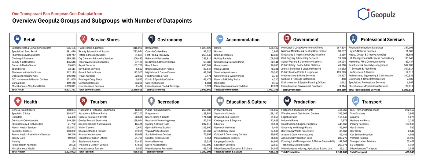
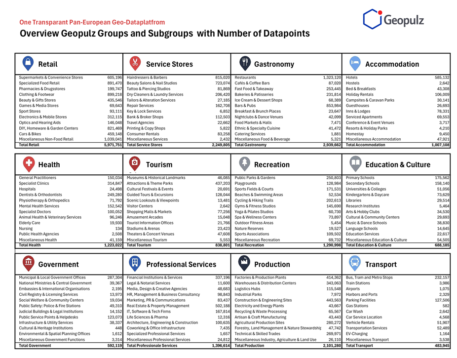
A Consistent Language for Urban Activities
GeoPulz classifies locations through a structured taxonomy that makes diverse urban activities comparable across Europe.
- 12 Groups
- 144 Subgroups
- 1000+ Categories
03 — GEOGRAPHIC ZONES
Context at Multiple Scales
GeoPulz connects every location to a consistent geographic framework — from countries and regions to municipalities and local areas, complemented by a uniform H3 spatial grid.
04 — DATA METHODOLOGY
From Source to Structured Intelligence
GeoPulz transforms diverse web and geographic sources into structured, comparable and continuously updated location data.
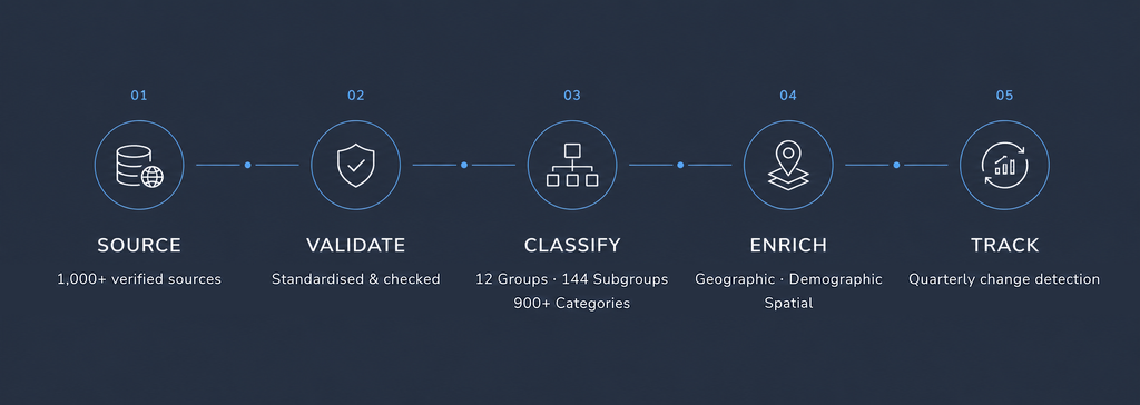
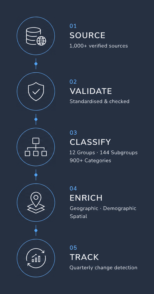
From verified sources to taxonomy, geographic context and ongoing change detection, each location passes through a consistent data process designed for reliable analysis across Europe.

05 — ANALYTICS ENGINE
Location Intelligence for Deeper Analysis
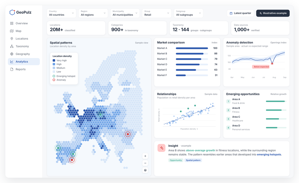
Structured location and geographic data create the foundation for advanced analytics and AI. GeoPulz can identify spatial patterns, detect anomalies, compare markets, reveal relationships and surface emerging opportunities across millions of locations and geographic areas.
06 — APPLICATIONS
From Intelligence to Action
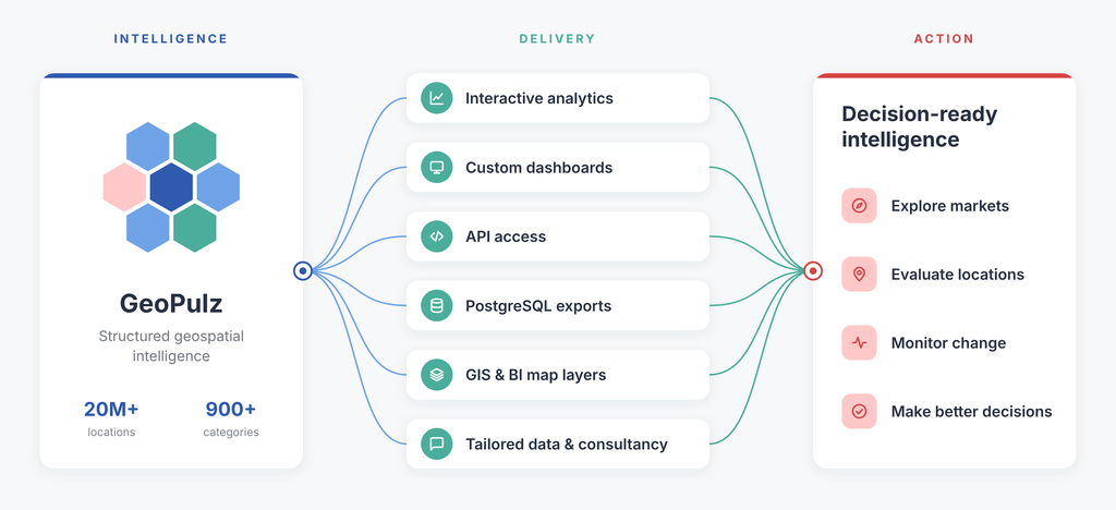
GeoPulz turns structured geospatial intelligence into products, applications and decision-ready data. The platform can deliver location and geographic intelligence through interactive analytics, dashboards, data products and tailored integrations — helping businesses explore markets, evaluate locations, monitor change and make better-informed decisions.

Insights
Market Report 2026
Company
About us
Contact us
Contact
info@geopulz.com
Rua de Brito Capelo 1127
4450-070 Matosinhos, Portugal
Linkedin
Insights
Market Report 2026
Company
About us
Contact us
DATA PLATFORM
Structured location data
for every place in Europe
A transparent data foundation connecting millions of locations with
geographic areas and analytical context across Europe
DATA PLATFORM
Structured location data
for every place in Europe
25M+ Locations · 1000+ Categories ·
1M+ Geographic Zones